


This post will be a little different to usual.
No adventuring along 4wd tracks, no remote area isolation, instead it covers the 4 months we have spent living in a town!

Except this is not your average town. It is probably the most remote ‘full size’ town in Australia. A town steeped in both aboriginal, pearling & seafaring history.
An outpost far enough away from the rest of Australia to have developed it’s own unique flavour & identity.
A melting pot where mixed races from Asia, Europe, Indigenous & the rest of Australia are the norm.
Where tide times have as much importance as clock times.
A tropical town surround by stunning Reds, blues & greens of ocean, skies, sunsets, sunrises, dunes, pindan cliffs & more, but which often gets mixed reviews.


Today it’s a tourist town first & foremost during the dry season, when it is at it’s busiest & most expensive, during the wet season it a quiet country town with busy port & a strong sense of community.

Those who visit only as tourists often find it busy, & overpriced & leave wondering what all the fuss is about, but those who are able to stay a bit longer & immerse themselves in ‘Broome-time’ tend to fall in love with the place. Many longtime residents can tell similar stories of arriving for an expected short period, but years later are still here, or are folk who somehow always find themselves returning here.

Like any town it’s not perfect, but it’s pretty bloody good.
I guess it’s obvious that we like Broome a lot. We could easily envisage settling here, but for two things. Anywhere coastal in Australia housing is expensive. Affordable if working here & earning the sort of wages that are required to attract folk to such an out of the way place, but for retirees like us without such an income buying a home here is only the stuff of dreams. That’s one thing, the second also applicable to folk of retirement age & older is access to health care. There are good basic services here in town, including the non residential hospital, but more complicated services are in Perth, over 2200kms to the south. Residents get cheap flights, but it’s still a long way from friends & family.


Unusually for a town with a population of under 20,000, Broome not only has an international airport, but an international airport smack bang in the middle of town! However although having daily jets flying in & out, instead of being a noise nuisance it seems to be well tolerated & simply a part of life here, an aspect of it’s uniqueness. We might hear the occasional plane but it hasn’t really impacted us. Far less intrusive than living near a busy road.


No traffic lights in Broome.
We arrived back here unexpectedly, our 3rd time here, without any certainty about how long we might stay or what we might do. In the past we have done a little house sitting & quite a lot of remote wet season caretaking. There is a fuzzy line between what constitutes house sitting & caretaking, but generally caretaking involves a bit more work. What we had not done prior to our time here in Broome this time was ‘back to back’ house sitting and we arrived uncertain of what might be possible.

Our truck is well designed for good airflow, but we had already discovered that living in it during sustained temperatures north of 40 degrees, with high humidity was hard yakka, & not something we would do out of choice, a fallback position best avoided if possible.
Our thinking was that if we could manage to find house sits with minimal gaps between them any gaps that we couldn’t fill we could head out of town & camp for short periods.


Social media, Local Facebook groups in particular, have proven to be a great way to ‘advertise’ our availability as house sitters, and whilst juggling of dates to suit both homeowners & ourselves was fairly hard going early on, & made more of a roller coaster by a couple of cancellations after agreements had been made, overall it has worked out very well.

We were able to leave our camp up at Willie Creek with firm arrangements made from the end of January through to mid May (when we want to move on). BUT with a 10 day period in the middle where we had nothing arranged. MrsTea was optimistic that ‘something would turn up’, I was less positive.
As it turned out something did turn up, something we were quite excited about, in a remote spot about 160kms north of Broome, up on the Dampier Peninsular, but a few weeks later it was cancelled. The owners were very apologetic, explaining ‘unexpected family issues’ were the reason, but we were still back on the roller coaster with only a couple of weeks to find something else. Although we have the fallback position of camping the process has been a reminder of my need to feel in control. We do have a fairly carefree lifestyle, but it’s fair to say that I like to feel that we are ‘in charge of ourselves’ rather than dependent upon the uncertainty of others. So I struggled with our lack of certainty more than MrsTea. I can handle it but don’t find it enjoyable.

The wet season at this point was at it’s hottest & most humid. I was resigned to paying what were now significantly higher prices for a caravan park site than they had been back in January. Not what either of us wanted. However accepting this was how it was to be – a decision in itself, helped me feel better. It’s always the same, issues arise & I struggle & agonise until a way forward is found. (It always is). Crazy really because travelling as we do requires ongoing day to day flexibility. I know that & I also know that this is often a major factor why many folk say I wish I could live like you, but……. (insert reasons why they can’t).
I’m not a masochist, I know there are going to be times I don’t enjoy, but I have always believed that the best way to manage the things which I find uncomfortable is to confront them, and I do, but somehow ‘not feeling in control’ just never gets any easier. MrsTea on the other hand has the ability to switch off, to distract herself & just carry on. She too, like anyone has her vulnerabilities, but together we are a pretty good team.

Out of the blue (surprise surprise!) we were asked to do a 6 day sit – the last 6 days of the unfilled 10 day period.
The swap over with the following sit we had booked would be perfect. Only 4 unfilled days now, not so bad at a caravan park.
BUT THEN we were asked to return to what had been our first sit for those 4 days so the lovely owner could go to her fathers birthday in Perth! It couldn’t have been more perfect. The owner had seen our Facebook ‘advertising’ & saw we were still in need, as well as seeing an opportunity to see her dad on his birthday. How good was that (Thank you again Louise!).
So from the end of January through to mid May we have had 5 house sits, with no gaps, & all with pets to be cared for, all in lovely homes & all but the 6 day one with a car provided for our use. Our sits have been approx 6 weeks, 3 weeks, 4 days, 6 days & 4 weeks.


Would we do the same sort of thing again to stay somewhere for a while. Well yes, I think we would, but it’s fair to say that we will always prefer sits for longer periods rather than multiple shorter ones.
Having cars to use certainly made getting a few things sorted with the OKA (more on that later) so much easier. It also enable us to take dogs to beaches, made shopping easier & allowed us to drop off & collect most of our home owners to & from the airport.
We have become quite proficient in the process of transferring our ‘home’ from the truck to house & back to truck. It no longer feels like a big deal. We take pride in moving out & leaving someone’s home just as we found it for them to return to. This is aided by taking photos all around the house & gardens as soon as the owner has left & before we move our own stuff in. Our stuff gets listed as we bring it in …. well it did at the beginning, but as we have moved in & out several times we have become more familiar with what we take in & out & our lists have reduced & become less specific.


Comfort has been a big deal, something we have very much appreciated in every home. All have had very comfortable beds but better still comfortable chairs. These we think are often taken for granted, but after you have lived with camp chairs for long periods, or have been somewhere where nobody actually lives full time & comfy chairs are non existent having the sort of settees & chairs you can just sink into, but which offer the necessary back support, it’s like stepping into heaven. And in that regard every Broome home we have looked after has been heaven!


MrsTea has spent a lot of her time enjoying her watercolour painting, specifically painting portraits of the pets we have cared for. Although she still considers herself a beginner we have both been very aware of her improvement over our time here. New skills & techniques learned from painting to painting. And accepting how important it is to get the initial pencil drawing dimensionally accurate in order to improve ‘likeness’ (even though she says that is the least interesting part of the process).


What really boosted her confidence was the owner of the first house finding the portrait she had left of Tangles the cat. She liked it enough to ask if MrsTea would take a commission for a portrait of her recently departed & beloved dog ‘Oscar’. MrsTea was hesitant, certain she would not take any payment but not feeling confident she could manage a competent result. She agreed to give it a try. Several photos were emailed to her & she chose one of quite a young Oscar with a freshly clipped coat. On completion we both thought it her best to date.

When she gave it to the home owner there were hugs & tears from both of them. A special moment for each. A surprise that a painting could be so powerful. This was the owner who had us back for the 4 days. Upon her 2nd return she handed MrsTea a paper bag from an art shop in Perth containing several high quality brushes & some high quality art paper. MrsTea was absolutely stoked that someone might think highly enough of her effort to be so generous in return. Since then she has secreted a portrait of each pet at each house for the owners to discover after we have left. And having some better brushes is something she continues to appreciate. I love that she loves what she does & her finding that quality brushes enable better execution of technique tells me that she is also recognising something positive in herself as a result.


In addition to the painting, she has become enamoured with what essentially seems (to me) to be another art form. That of baking sourdough bread. She had experimented with making some it for the first time whilst we were caretaking at Mt Elizabeth Station. The results there whilst tasty, had poor texture, & were too solid & dough-y. She was trying to make her own ‘starter’, but had problems with this.
When we reached Broome, through local facebook groups, she has been able to connect with locals who bake their own sourdough & who were more than happy to give her some of their starter. It seems that with regular ‘feeding’, the starter can last indefinitely, & to date it has. (This bodes well for taking with us when we leave house sitting behind & get back on the road soon).
Apparently it is common for those who share their lives with sourdough to have names for their ‘starter”. MrsTea’s is named ‘Olive’.
Since then she has generally baked twice a week, making yummy bread for both ourselves , for returning homeowners & for a Broome friend we have made who happily exchanges Pawpaws & Eggplants from his garden. Like the painting this too continues to evolving. The addition of a small quantity of olive oil to the bread mix has resulted in a pleasing slightly softer texture & apparently helps the bread to last a bit longer.


Youtube has been an excellent resource for both painting & sourdough baking.
We now buy bakers flour in 5 kg bags.
The weekly Broome market has a Sourdough stall where loaves a little smaller than ours sell out every Saturday priced at $13 to $16. Doing it yourself costs a fraction of that & it seems that making your own can be quite addictive. As a recipient of this addiction I have no complaints!
There are unexpected (to me) bonus offshoots too.

Sourdough Focaccia is apparently easy to make & very nice, & the most recent discovery is the beautifully soft & fluffy sourdough naan. Also easy to make, & with the naan has come a delightful new curry both of which I am told should both be quite easy to make whilst we are travelling. Chicken & pumpkin miso curry. We just had it for lunch – the 2nd time she has made it & I’d have to say it is restaurant quality eating. We hope bread making will also be successful whilst travelling but it will no doubt take some experimentation in our small cast iron camp oven. If it works ok I’m guessing we may have more regular camp fires. We have never been campers who need a fire just for the sake of it, but having a reason for one is different. 🙂
Apart from Tangles the cat, all of our other ‘charges’ have been dogs. It has been so good to have dogs back in our lives for a while. It’s something we have missed greatly whilst travelling, even though we remain adamant that we will have to wait until we relinquish our travelling lifestyle before having another dog of our own. I should add that although not really ‘cat people’, we also very much enjoyed Tangle’s company, especially as he became less aloof & warmed to us. But we are dog people. Not only have we enjoyed the company of ‘Grace’, a 3 year old Kelpie, Indi a 3 legged 7 year old Irish Setter, who had had a rear leg amputated just a couple of weeks before we looked after her, and currently ‘Rosie’ who is the most gorgeous little Broome Bitsa who loves us as much as we love her. It really is amazing how quickly dogs bond with us …. & vice versa. After a little initial boundary testing Rosie has bonded to us exceptionally well, and we completely trust her when it matters. All of course have introduced us to other dogs & their owners we have met when out walking.


Walking. There are great beaches to walk & play with other dogs on. At what is the hottest time of the year, the sun is not only hot, but harsh, meaning that going out to the beach early in the morning is best for all concerned. We have become used to being up by 5-5:30am & out the door soon after. Once out on the beach it’s wonderful, although I’d be lying if I said I never hankered after a lay in from time to time.

Most days the morning beach walk has been the day’s main event. Evening walks being generally closer to home & a little shorter. On the many days where we haven’t needed to go out for anything else, whilst MrsTea reads or paints I have succumbed to the magnetism of Tv, when scrolling through social media has worn thin. Not only have we had the availability of Tv (which we don’t have, nor want, whilst travelling) but we’ve had ‘Smart, large screen TV’s. There has been some binge watching! Not only the news showing us ever increasing horrors of the Palestinian genocide, overlaid with Trump’s geopolitical & bizarre self aggrandisement at home & in in the Middle east, & Netanyahu’s continuing nationalist attacks in Lebanon, but also the results of these here at home in the form of forecast shortages of fuel & increased prices of everything. I suppose it is not overly surprising that whilst often compulsive viewing, it also becomes very tiring & some lighter relief is required. I have lost count of how many episodes of Itchy Boots I have watched. One woman’s regular account of her adventures as she rides alone around the world on a motorcycle on Youtube. It has been so enlightening to see her travelling though countries which some would have us see as either enemies, or peoples who are somehow less than human. These are beautiful countries & like most people everywhere are just people, often far more generous & hospitable than expected. There was the full set of the ‘Long Way’ series’ on Netflix with Ewan Macgregor & Charley Boorman riding motorcycles on long overland trips accompanied by a film & support crew. Quite different to Itchy Boots, but enjoyable nonetheless. And an espionage thriller – ‘Tehran’ on Apple Tv, Being American the Israelis were the goodies & the Iranians the baddies but nonetheless it was good watching with a very enjoyable musical score, in part aided by the excellent sound system for the Tv.
It has been nice to be couch potatoes for a while, but we have still managed to get out & about a bit , in addition to beach walks. Weekly shopping, Saturday markets, op shopping, getting things sorted on the OKA, Getting vaccinated (Covid, Japanese Encephalitis, & Flu – were supposed to get RSV as well but the supply of vaccine was delayed & now now not available until after we leave town – all free , at the Broome Community Health Clinic). You have to take the opportunity to do these things when you can whilst travelling. MrsTea had an overdue breast screen &I’m lined up for an overdue skin cancer check in a few days time. Meeting & mixing with locals as ‘sort of locals’ ourselves engages with the ‘vibe’ of the place.
We still go to bed early, often when darkness falls, no late night TV marathons, but we did make one exception when we learned that the Broome musical legends, the Pigram Brothers were re-uniting to all play together at the 20th anniversary of the Yawaru native title over Rubibi (Broome). They don’t generally all play together much these days so as Pigram fans it was an opportunity not to be missed – all together & on their home turf! Great night!


MrsTea has continued her regular weekly coffee outings with Correlie from Willie Creek & we have had our travelling New Zealand friends, whom we travelled with for a while around a year ago, visit. We took them out on a bit of a tour around being the ‘locals’ & it being their first time here.

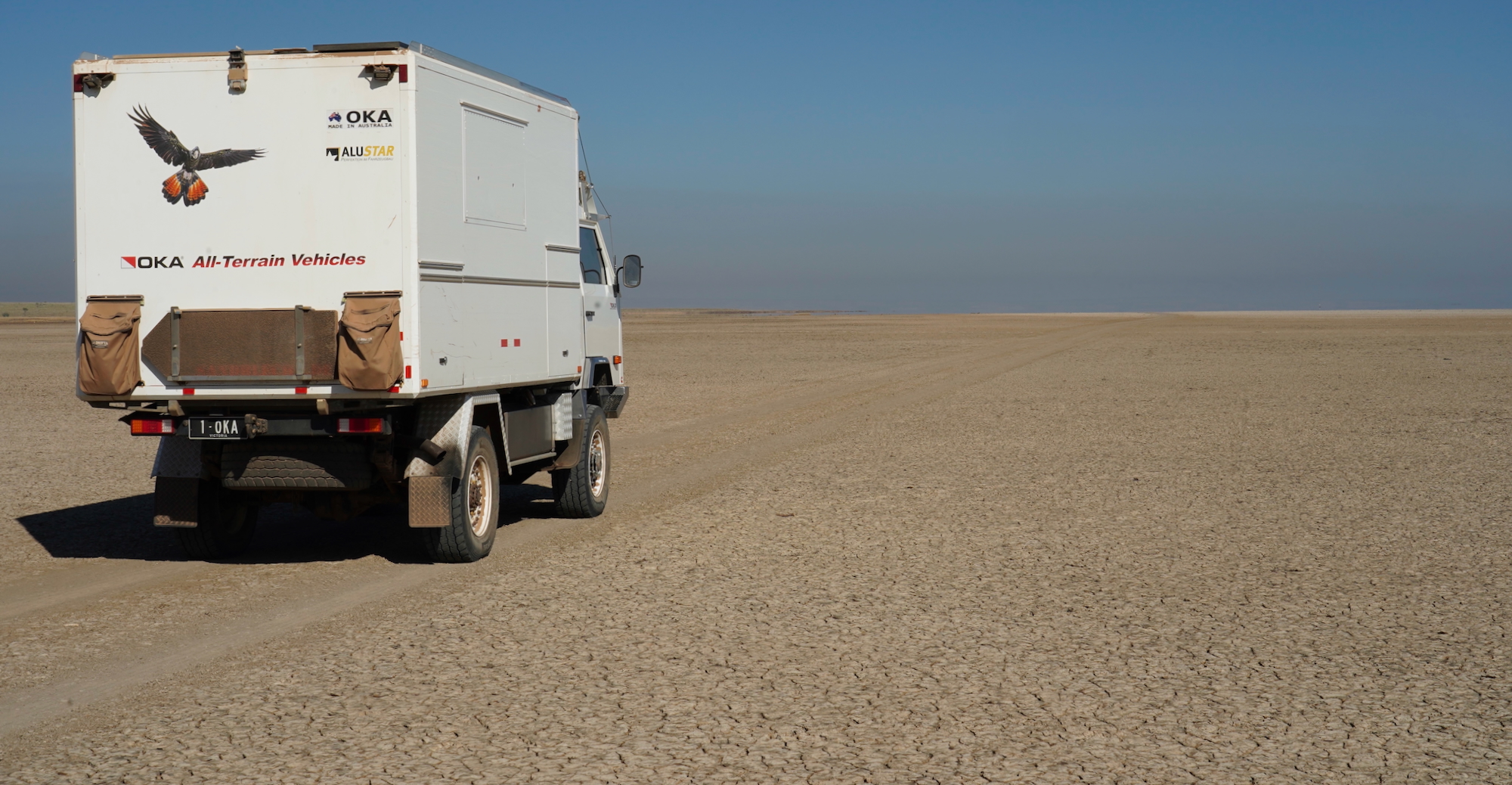
Aside from the water monitoring issue I wrote about in the previous post there have been a few other things to get sorted with the OKA. First was a couple of new tyres, the ones promised but never materialised back at Mt Elizabeth.
The tyre shop had to order them in, but had them within 4 days! I stayed to watch the demounting & mounting process – good to see it done in case I need to do it myself somewhere out in the bush. These are not your run of the mill wheel rims, only a handful of OKA’s were fitted with them. Military wheels, specially modified to fit the OKA’s also modified military axles. The process had the tyre fitter bamboozled for a bit. They are a two piece rim with 20 studs/nuts holding the two halves together, with a large o ring between them to allow the use of tubeless tyres. No tyre irons required. Undo the 20 bolts & then screw 3 bolts into threaded holes to push the two halves apart. All sounds straight forward but don’t forget that each rim/tyre combo weighs 90 kg! All was done until the final stud when doing it up stripped the thread. The next two hours were spent going from business to business (following recommendations of well meaning folk who hadn’t been able to help) to find a replacement. Even though the new tyre was holding air with only 19 studs, I wanted 20. Finally found an auto shop who after asking ‘What vehicle is it for” & me telling him “It’s on an OKA, but that will be of no help to you” measured up the damaged stud, found a near match on his computer & said he could get one within 10 days. It would be too long but the rest of the specs suited, so went with that & cut the extra length off when it (& a second spare) arrived.
Next was the driving cab’s air conditioning. It had ceased working. My hope was a simple broken wire but it wasn’t to be. When I found the cause it was very obvious what had happened. Corrugations had caused the mounting for the receiver/dryer to break, & its weight bouncing up & down has caused one of the aluminium pipes connected to it to break right off , releasing all the gas.
I needed an air conditioning person with fabrication skills to repair, remount & re-gas for me. Several air con places I enquired about got a bad rap from locals, but Mick, a long time Broome resident & the chap who has become a mate & who we have been exchanging MrsTea’s bread for produce from his garden, recommended Bob, an ‘old school ‘ air con chap, saying the job would be right up his street. He was right. Bob’s has been repairing fridges & air con’s in Broome for decades & his yard was littered with dead fridges & air con units, but parked there were also commercial buses as well as caravans in for repairs etc. Talking to him was very reassuring & he did an excellent job mounting a new receiver dryer very solidly , but also added rubber hoses to replace the aluminium pipes – of which one had broken. A very professional job & a definite improvement on the setup, which should now be ‘corrugation -proof’ However Bob, now over 80 years old I believe, is a man who likes to do things ‘properly’ & when he found not a lot of air coming through the cab vents he took it upon himself to try to rectify this.
When he phoned me he had already dismantled a lot that I knew was making a relatively small job into something far bigger (time-wise). I knew he was trying to be thorough & do the best job he could, but he had come to realise that there were 20 year old mechanical components that were worn & that he could not fix. He suggested a ‘workaround ‘ which would give maximum cold air in the cab at the expense of having no demisting, which I agreed to.
I went to visit him on the Friday morning fearing that if I didn’t he would have the truck there for several more days. “I know you did it for the right reasons, but I’m betting you wish you hadn’t ” I said . He agreed that was indeed the case. I needed the truck back to get another issue fixed before we leave town, so suggested I stay there & we worked together to get what I knew would be a very fiddly time consuming job to get it all back together again. He was a nice fella to spend time with & we took 2 or 3 hours to get the job finished so I could drive it away. The cost ended up being 3 times what I had expected but it was what it was & we now have cold air con again, with slightly improved airflow. A job to be revisited when the OKA is eventually back home in my workshop.
The last job was something I had been putting off for a while, to fix was an oil leak which had been exasperatingly intermittent. The leak was from the oil seal on the rear differential/prop shaft connection. Oddly we could go for weeks at a time with no leakage. Checking the diff’s oil level revealed negligible oil loss. It hadn’t leaked at any of our house sits until this, our last one, & now it was not just a drip making a small puddle on the driveway, it was noticeably wet all around the seal area. I wasn’t concerned too much with the loss of oil. Topping it up is easy enough if needed, but leaks never get better, & Broome is the biggest town we will be in the foreseeable future.
Of greater concern was my fear about sucking water into the diff during water crossings we expect to encounter. If oil can find it’s way out, when a hot diff is suddenly cooled by water there is a way where water can be sucked in. Talking to a friend (Thanks Peter) convinced me it would be foolish to leave town without getting the seal replaced as the consequences could be potentially far more costly. I ordered a new oil seal (& a spare) from Perth & had it sent up before seeking somewhere to do the work for me. I had been told to expect the standard Broome mechanics response to “Can you do it”. “Sorry mate I’m flat out, cant fit it in for at least three weeks”.
Could have knocked me over with a feather when the second place I tried said ” Bring it in tomorrow morning at 7:15″ Always a worry when they can fit you in so soon, but this was a big place with road trains being worked on, I hoped that I’d just got lucky as to when they could fit in my relatively small job. They also had very high roof sheds where our 3.2m height would fit easily & pits to aid getting the job done more easily than a chap laying on his back underneath the truck. AND the mechanic I spoke to sounded pretty competent. They were as good as their word & I spoke with the mechanic after the job was done. He explained the nuances of our particular diff, said the old seal was visibly worn & also surprisingly (to me) that the diff oil was ‘slightly milky’ (something I had been unable to detect when sticking my finger into the filler hole) suggesting that small amounts of water had already been sucked in during water crossings. So getting it done was indeed necessary.
So the truck is now ready to leave town, & that will be happening in 9 days time. We’ll be heading back to our friends in Kununurra, taking a slowish trip back along the Gibb River Road once again. It has re-opened in the last day or so, a little earlier than we had expected. There are a couple of camp spots we would like to spend some more time at, & one in particular which was closed when we went that way last year, & we haven’t covered the eastern section between Mt Barnett & the Pentecost River since 2019.
We also think we may re-visit an awesome camp spot on the King River near Wyndham we which enjoyed last year. There should be more water flowing there now. In Kununurra we will again enjoy our friend’s very thoughtful hospitality, perhaps re-visit our favourite camp spot that we have stayed at in the OKA, after which we’ll be continuing eastward with a view to being in East Arnhem land in June/July. Really looking forward to that, we have never been there before. And following that we are hoping to get up to North Arnhem Land into the Garig Gunak Barlu national Park (Cobourg Peninsula) but this still remains uncertain. Our last contact with the folk there revealed uncertainty about if & when it will open this year, a result of a lot of damage to infrastructure at the campgrounds by Cyclone Fina last November. That is as far as our planning goes , so once we leave East Arnhem at the end of July some coin tossing may be required.
I would like to finish by welcoming all the new subscribers to our little space on the ‘net. I don’t regularly encourage folk to subscribe as I fear that doing so will make our blog look like the many money making blogs/youtube channels etc etc who’s primary motivation is harvesting ‘clicks. That said it was great to see that the mention I made of the benefit of subscribing to you, at the end of the previous post, has brought some new folk on board. I hope all of you continue to enjoy ‘travelling with us’. Your comments are always welcome, & we are always happy to do our best to answer any questions, or share our thoughts with anyone who takes the time to connect with us via email on our contact page.
Regards
Cuppa & MrsTea.
A couple more of MrsTea’s portraits – these of two good friends. Excellent likenesses. Each took several attempts.

